Submitted by Taps Coogan on the 23rd of May 2018 to The Sounding Line.
Enjoy The Sounding Line? Click here to subscribe for free.
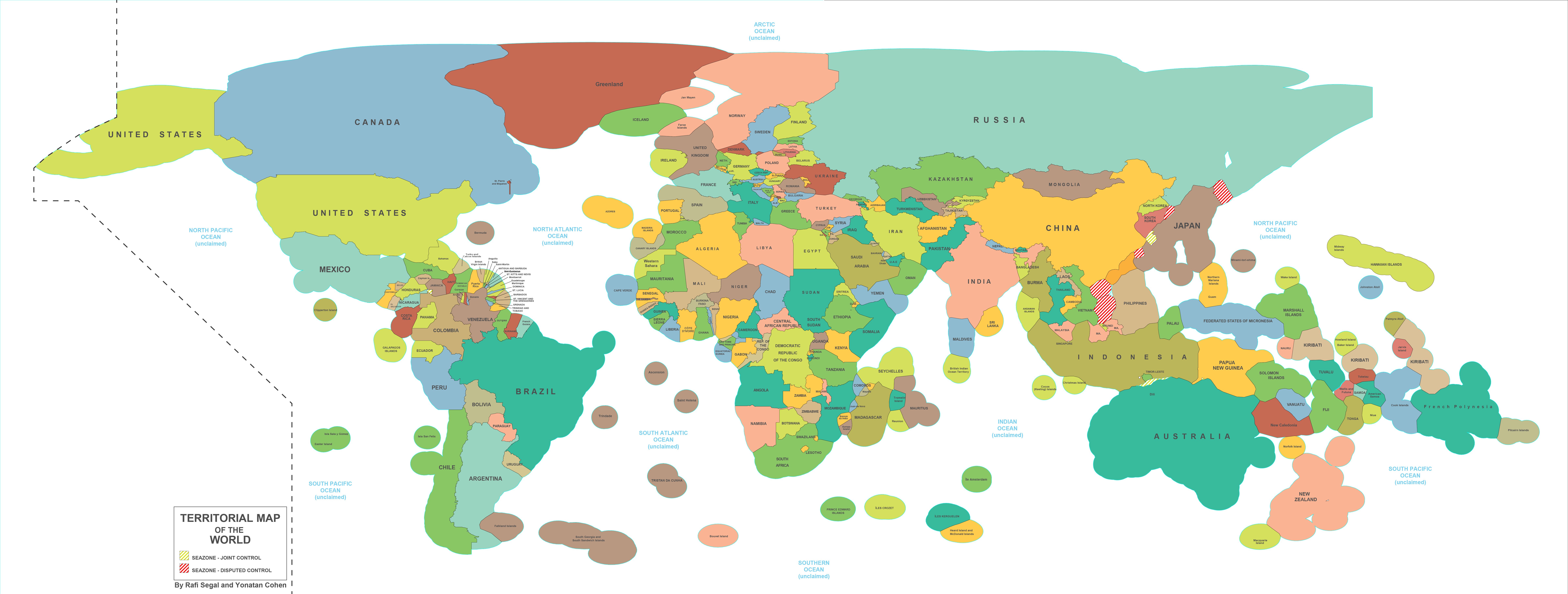
The following map, from openDemocracy.net, shows the territorial borders of every country in the world. Territorial borders include not just land borders but Exclusive Economic Zones (EEZ) as well. As open Democracy notes, EEZ are “sea zones whose resources belong to their coastal-lying nations. International law defines these zones as lying within a 200 nautical miles geometrical offsetting of the coast seawards, and, where these geometrical boundaries prove ambiguous, through international treaties.”
There are a number of contested regions demarcated by red and white stripping. The largest of these can be found in the Pacific around China and Russia. The map leaves several other contested regions out, not the least of which is the ongoing dispute between Greece and Turkey in the Aegean Sea.
P.S. We have added email distribution for The Sounding Line. If you would like to be updated via email when we post a new article, please click here. It’s free and we won’t send any promotional materials.
Would you like to be notified when we publish a new article on The Sounding Line? Click here to subscribe for free.


