Submitted by Taps Coogan on the 6th of October 2017 to The Sounding Line.
Enjoy The Sounding Line? Click here to subscribe for free.
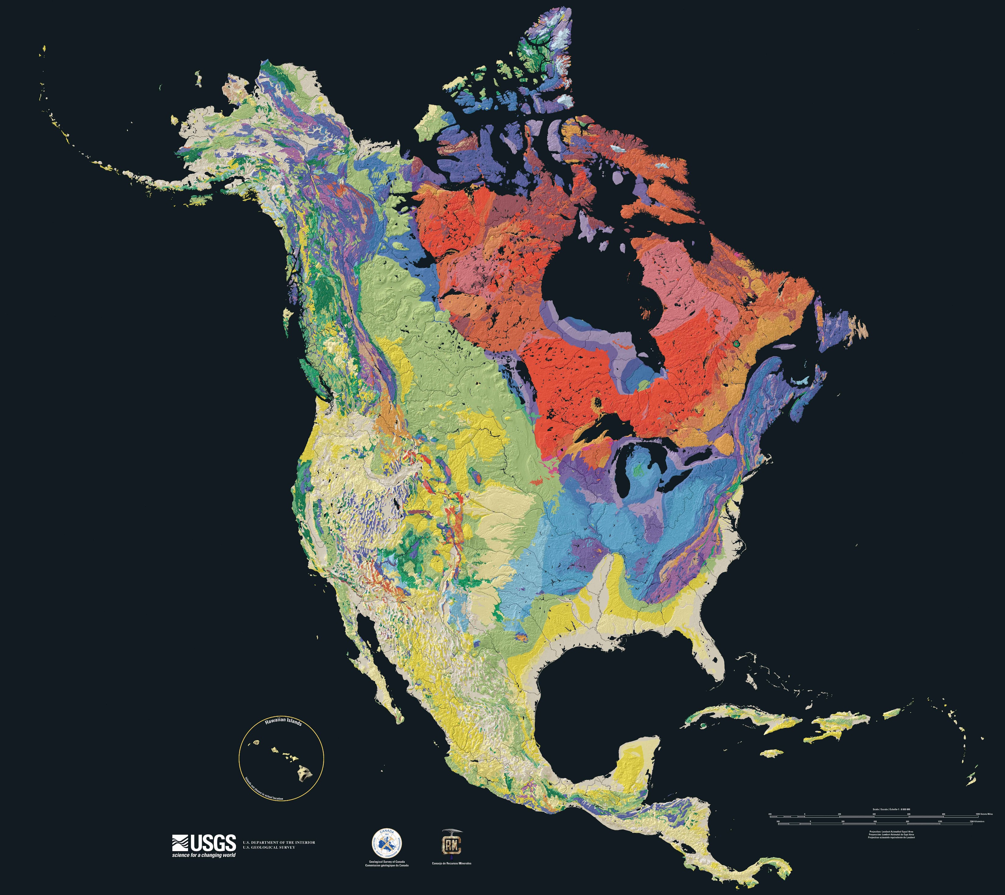
The following map shows the age of bedrock across the entire North American continent. As Brilliant Maps notes: “It was put together by Kate E. Barton, David G. Howell, José F. Vigil on behalf of the the U.S. Geological Survey in collaboration with the Geological Survey of Canada and the Mexican Consejo Recursos de Minerales.”
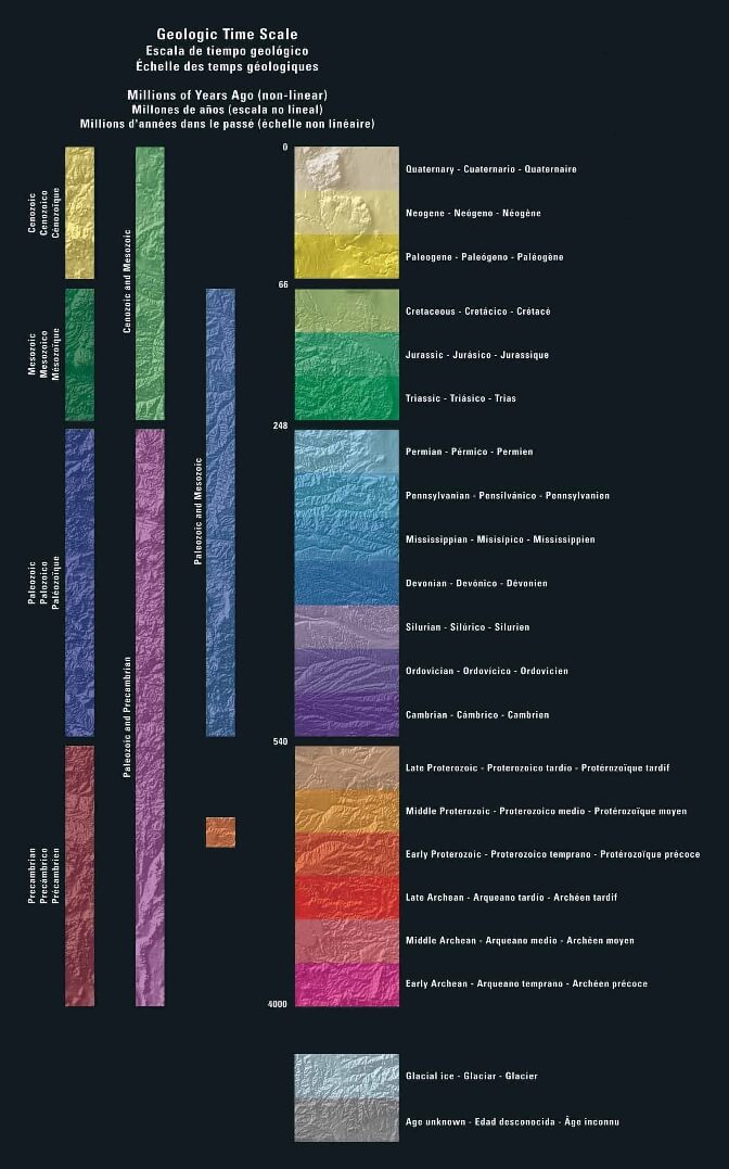
Regardless of whether or not you are a geologist, it is a beautiful image and must have been quite a piece of work. Below the map you will find another image with the scale to interpret the colors. In order of age, it goes from yellow (youngest), to green, to blue, and then to red (oldest). Enjoy:
Would you like to be notified when we publish a new article on The Sounding Line? Click here to subscribe for free.


