Submitted by Taps Coogan on the 21st of May 2020 to The Sounding Line.
Enjoy The Sounding Line? Click here to subscribe for free.
Enjoy The Sounding Line? Click here to subscribe.
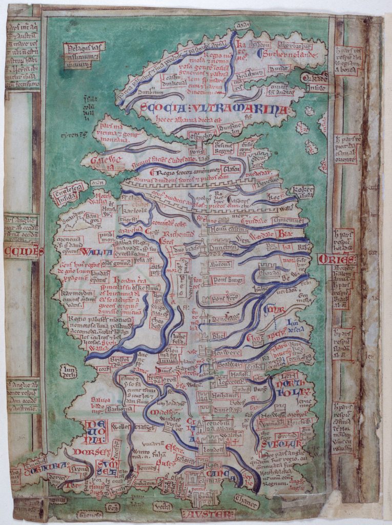
The following map of Britain was drafted by Matthew Paris (1200–59 AD). As the British Library notes “Paris, who did not travel far from his own monastery at St Albans in Hertfordshire, was the greatest English cartographer of his age, although his maps differ greatly from geographical reality… No fewer than 252 places are recorded on this particular map, including 81 cathedrals and monasteries, 41 castles, and 33 ports.”

Would you like to be notified when we publish a new article on The Sounding Line? Click here to subscribe for free.
Would you like to be notified when we publish a new article on The Sounding Line? Click here to subscribe for free.

