Submitted by Taps Coogan on the 17th of May 2020 to The Sounding Line.
Enjoy The Sounding Line? Click here to subscribe for free.
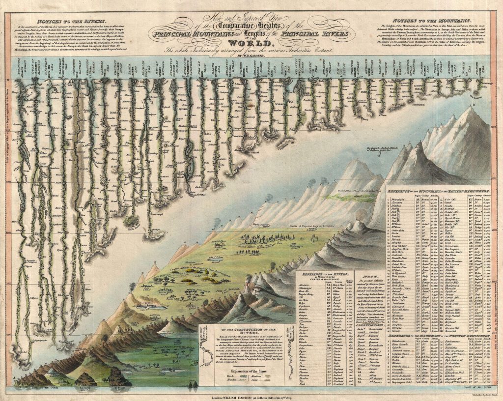
The first known example of a style that became quite popular during the 19th century, the following map was created by William Darton and W. R. Gardner in 1823 and details the lengths of the world’s principal rivers, the heights of its principal mountains, and the elevations of some of the era’s prominent cities.

Dhaulagiri was believed to be the highest mountain peak in the world at the time of this map’s creation. While it is actually the world’s seventh highest peak, it is the highest peak relative to its local terrain and was one of the last major mountain peaks to be successfully climbed, a feat that included the highest altitude landing of a fixed wing airplane to this day (it subsequently crashed at takeoff).
Would you like to be notified when we publish a new article on The Sounding Line? Click here to subscribe for free.
Would you like to be notified when we publish a new article on The Sounding Line? Click here to subscribe for free.

